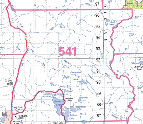
Panny River Wildlife Management Unit (541)
Commencing where highway 88 intersects with the right bank of the Wabasca River in township 97, range 9, west of the fifth meridian; thence southerly along highway 88 to secondary highway 686; then northeasterly along secondary highway 686 to the north boundary of township 86; thence easterly along the north boundary of township 86 to the intersection with the right bank of the Wabasca River; thence northerly along the right bank of the Wabasca River to the right bank of the Leige River; thence northerly along the right bank of the Leige River to its intersection with the west boundary of range 22, west of the fourth meridian; thence north along the western boundary of range 22, west of the fourth meridian, to the 25th baseline; thence westerly along the 25th baseline to the right bank of the Wabasca River; thence northwesterly along the right bank of the Wabasca River to the point of commencement.